Maps & Geolocation Functionality

Build Sophisticated, Location-Aware Apps

  • Enable and share geo tracking data
  • Integrate maps in any app
  • Customize map views, markers, and layers
  • Utilize real-time location data
  • Show current location and route between locations
  • Define custom actions for map clicks
  • Ensure consistent cross platform functionality
  • Native map functionality for iOS, Android, Windows

Build Apps with Maps

Altova MobileTogether includes comprehensive maps and geolocation functionality that enables developers to create feature-rich mobile and enterprise apps in record time.

Whether you’re building a navigation app, tracking assets, or providing location-based services, MobileTogether makes it easy with its low-code, cross platform approach. Its visual design tools and pre-built components allow you to quickly add and configure maps and geolocation features without extensive coding.

Building apps with maps

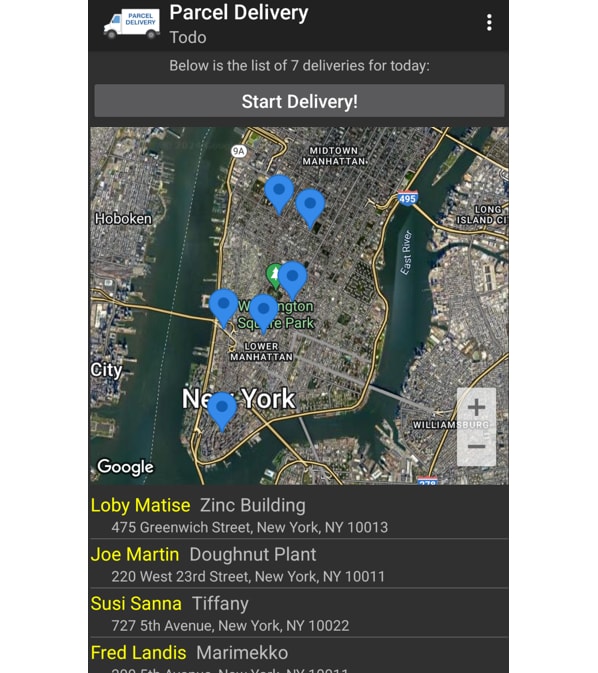
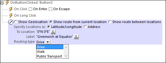
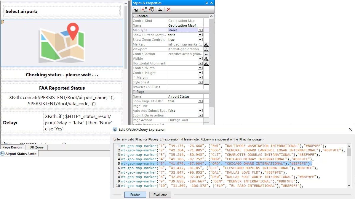
To integrate maps in your app or enterprise solution, simply drag the Geolocation Map control into the design area in MobileTogether Designer. You can customize the properties to display the map of a specific area in street, satellite, or hybrid view (which can optionally be changed by app users), and specific points of interest can be shown by markers as defined in the app or based on the user's location.

Any number of markers can be defined in the control's Markers property. The current location as well as zoom controls can optionally be included in the map. The size and magnification of the map that is initially displayed in the control can be defined via the Viewport, Control Width, and Control Height properties. The Geolocation Map control also has a OnGeoMapMarkerClicked event, which enables you to define actions to perform when a particular marker is clicked by the user.

Defining map properties and display in an enterprise app

On each device running your app, the map is generated using its native, built-in map application. End users will automatically see the familiar style and format on each platform.

Geolocation Services

In addition to map functionality, geolocation actions in MobileTogether can be defined to read and share geolocation data (e.g., to share a location via messaging or social media apps), start/stop geo tracking, and show the current location. These actions are available for page events and control events.

Using the powerful ActionTrees visual app programming language, you can drag and drop the Geolocation actions to define sophisticated behavior in your apps in a single design that targets iOS, Android, and Windows.

Actions for enabling geolocation services in apps

To test and debug geolocation services while developing your app, you can supply a set of sample geolocation data in an XML file to use during simulation.

Once your app is finished, deploy it to enterprise users via the free MobileTogether client app or generate source code for a custom, native app store app.

Supported Platforms:

  • Android
  • iOS (iPhone, iPad)
  • Windows 10 & 11
  • HTML5 browser for other users

MobileTogether Feature List

MobileTogether FAQ

MobileTogether Video Demos